See it on a Map
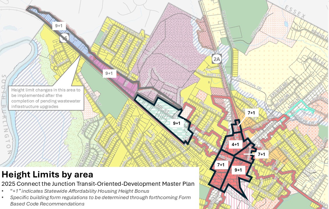
The map below shows where the form-based code applies and the maximum building height in each subdistrict. Height limits vary by location and were set with local sensitivities in mind. Most parcels are not expected to see the tallest buildings; the map shows what is allowed, not what is planned or likely.